During this season’s rafting trip down the Firth river in Ivvavik National Park. It was possible to get a few Panorama photos of the landscapes that are in this amazing area.
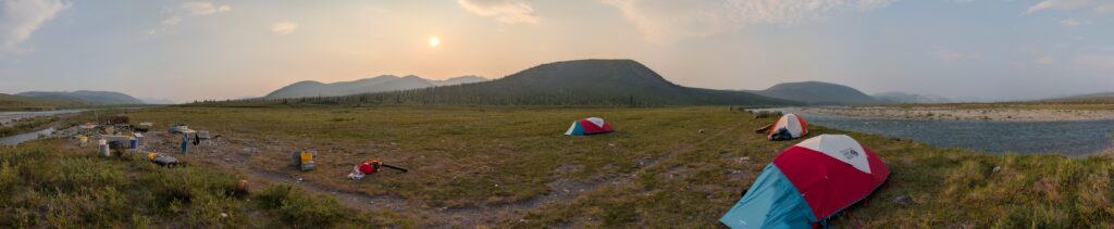
In this picture we are getting camp set up and waiting for the clients to fly in the next day. To the left, in the distance is where the auefis provides the flow for the river and to the right we are looking downstream where we will spent the next 13 days floating, hiking and exploring our way down river as Parks Canada staff will be doing a variety of assessments as we travel downstream.Hiking in the Firth Valley is all time. Here we hiked up a ridge after fishing for Dolly Varden Char (Dinner that Night) and having a delightful riverside lunch. This gives us a chance to check out different bird life and many different types of flowers. This picture has us looking downstream toward Crooked Creek. Rafts pulled up at a camp just upstream of Joe Creek, the main tributary to the Firth. Stormy weather overhead, however excellent spots to go for a walk to have a look at Joe Creek and look for wildlife. Clients looking out over an ice filled Joe Creek. With a colder spring the Aufeis was holding on longer. Made for an impressive sight. The ice here was close to 8ft deep. Aufeis is a sheet-like mass of layered ice that forms from successive flows of ground or river water during freezing temperatures. This form of ice is also called overflow, icings, or the Russian term, naled. Stopped at a water quality stop on the Parks Canada trip as we have now entered the Mountain reach of the Firth River. The Mountain being one of the four reaches. The others being the Aufeis, Canyon and Delta reaches. Here is a view from a high point above Wolf Tors camp on the Firth. Camp is a ways down toward the middle of the picture. This is a solid hike for clients. Sometimes we get here and others times we don’t. When we do the views are pretty amazing. It makes an excellent place to have lunch and scout for wildlife. Deep in the canyon section of the Firth at a water sample stop. The Parks trip gives people a few more stops along the river sections each day. Hikes on the Firth give you the ability to get some pretty good views. This is a good lunch spot near the river and then a easy/moderate hike to the view point overlooking the canyon section of the Firth with great views of the British Mountains. A view from layover camp looking out toward the coast. This is a neat place as we start to transition from the canyon to the Delta reach a day downstream from here. On our way to the ocean. Deep in the delta reach and hoping for enough water to take us to the Nunaluk lagoon. Nunaluk Lagoon is a geographic feature on the coast of the Yukon in the Canadian Arctic, located at latitude 69°33′01″N, longitude 139°33′25″W. It is situated near Nunaluk Spit. From there we spend a couple of days at Nunaluk spit on the edge of the Beaufort sea and WorkBoat Passage. Workboat Passage is a specific waterway between Herschel Island and the mainland in the Beaufort Sea, serving as a crucial part of the Northwest Passage maritime route. It is known to be a protected area where sea ducks feed and molt and was named Workboat Passage after the vessels that would navigate this area. Its importance lies in its role as a navigational channel for ships transiting the Northwest Passage.


No responses yet